Drumochter Munros
|
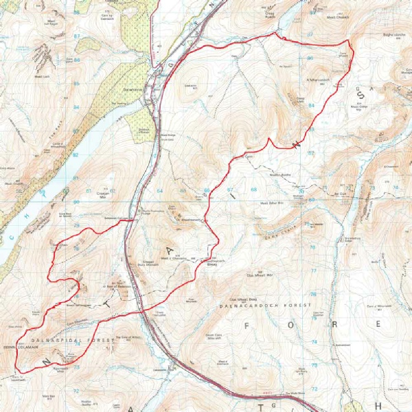
The route taken to cover these Munros straddles both the west and east sides of the A9 near Dalwhinnie. The amount of ascent to cover the peaks is relatively small and the terrain easy underfoot with no significant navigational issues. Wide, sweeping skies and gentle curving slopes are the order of the day. The peaks on the western side of the A9 have more character and interest to climb. However, it would have been nice if there had been less mist so as to afford a good view across to the Ben Alder, which I had climbed during my May Munro session. |
|
Geal- |
917m, 3007ft |
| |
|
A'Mharconaich |
975m 3198 ft | ||
|
Beinn Udlamain |
1011m, 3316ft | ||
|
Sgairneach Mhor |
991m 3250ft | ||
|
A'Bhuidheanach Bheag |
936m 3070ft | ||
|
Carn na Caim |
941m 3086ft | ||
|
|
| ||
|
date climbed |
27/7/2014 |
time taken |
12 hours |
|
distance |
43 km |
ascent |
2000m |
|
OS Map |
Landranger 42 |
Weather |
Misty at times |
|
Starting point : Balsporran Cottages on the A9 south of Dalwhinnie | |||
|
The day’s weather looked challenging from the point of view of mist so it would be a good opportunity to refresh the key navigational skills of map and compass. The Steve Fallon route was followed without any great difficulties and normally these six mountains are taken over 3 days of ascents. As usual after a time away from the Munro challenge, the first summit climb of Geal- |
|
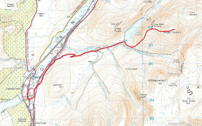
Meall Chuaich |
951m |
| |
|
|
| ||
|
|
| ||
|
|
| ||
|
|
| ||
|
|
| ||
|
date climbed |
29/7/2014 |
time taken |
3 hours |
|
distance |
4 km (6 km on the bike) |
ascent |
610m |
|
OS Map |
Landranger 42 |
Weather |
Good clear visibility |
|
Starting point : | |||
|
A very straightforward ascent with the bike being used to for the return journey up the track to the start of the climb. Good views from the top. |